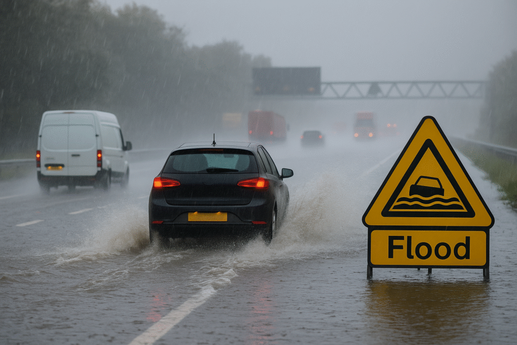
The UK is preparing for one of the most disruptive weather events of the season as a powerful rainstorm sweeps across the country. The Met Office has issued urgent warnings for heavy rain, rising flood risks, and widespread travel disruption. With conditions worsening hour by hour, communities, businesses, and travellers are facing a challenging weekend.
Forecasters warn that some regions could see up to a month’s worth of rainfall within a single day. Areas already saturated from recent showers are now under pressure, increasing the likelihood of flash floods and travel delays. Authorities are urging the public to stay alert as rivers rise and ground conditions worsen.
Heavy Rain Soaks the Midlands and South Wales
The Midlands and South Wales are expected to experience the most intense rainfall. Downpours are spreading across these regions this morning and will continue through the afternoon before shifting southeast. Rainfall totals may reach 80mm in some areas, exceeding what many cities typically receive during the entire month of November.
Places such as Birmingham, Nottingham, and Bristol—cities that usually record around 70–80mm of rain in November—may reach or exceed these totals in a matter of hours. With soil already saturated, much of this rain will run off quickly, increasing the threat of localised flooding.
Higher-altitude regions such as Cumbria, Lancashire, and the Isle of Man may even see wintry showers as colder air mixes with the storm. Southern England, however, will face steady, intense rain throughout the day.
Flood Alerts Climb as Rivers Swell
More than 30 flood alerts have already been issued across the UK, with particular concern in the East Midlands. Rising water levels along the River Erewash in Derbyshire and Nottinghamshire have placed several communities on alert. Rivers in Gloucestershire, especially around the Forest of Dean, are also being monitored closely.
Emergency responders are prepared for rapid changes in conditions as water flows intensify. Local authorities are urging residents in low-lying and flood-prone areas to prepare protective measures and stay updated with official warnings.
Major Travel Disruptions Expected
Travelers should expect significant delays throughout the day. Roads across several regions are at risk of flooding, increasing journey times and making driving conditions hazardous. Spray, pooled water, and reduced visibility will pose added dangers for motorists.
Public transport is also expected to be hit. Bus routes may be diverted or suspended, while train services could face delays or cancellations as tracks become waterlogged. Travellers planning long journeys are encouraged to check for service updates before leaving home and allow extra travel time.
Risks to Homes, Businesses, and Essential Services
The storm brings several serious risks that could impact daily life, including:
- Flooding of homes and businesses, especially in areas with saturated ground
- Road closures as water levels rise and routes become impassable
- Power cuts and temporary outages if flooding affects electrical infrastructure
- Temporary isolation of rural communities where access routes become blocked
Authorities are preparing for potential evacuations in the most vulnerable zones should conditions worsen. Residents are advised to secure valuables, prepare emergency supplies, and take early action to protect property.
Scotland and Northern England Also Affected
Northern regions are not immune to the storm. The Scottish Highlands saw more than 40mm of rain on Thursday, and parts of Northumberland received around 25mm. Today’s heavier bands of rain are expected to increase saturation, placing more pressure on rivers and drainage systems.
Even though a brief improvement is forecast for Sunday, another round of heavy rain is expected on Monday. Southern England will once again face the strongest rainfall, adding to an already challenging weather pattern.
Caution Urged for Travellers and Residents
Officials are urging the public to stay cautious throughout the weekend. Drivers should reduce speed, maintain longer stopping distances, and avoid flooded roads. For those using public transport, monitoring service updates is essential.
Residents in areas with flood history should remain vigilant. Simple steps such as clearing drains, raising electrical items, and preparing sandbags can reduce damage. With warnings in place for several counties, early preparation may make a significant difference.
Continuing Weather Concerns Into Next Week
Though today poses the highest immediate risk, the unsettled weather pattern will persist. Forecasters expect Monday to bring further downpours, especially to southern parts of the UK. This could prolong existing flooding concerns and further disrupt travel.
For now, the priority remains staying safe, reducing travel where possible, and heeding official advice. With one of the season’s heaviest storms underway, preparation and awareness are key to navigating the coming days.
For more travel news like this, keep reading Global Travel Wire


