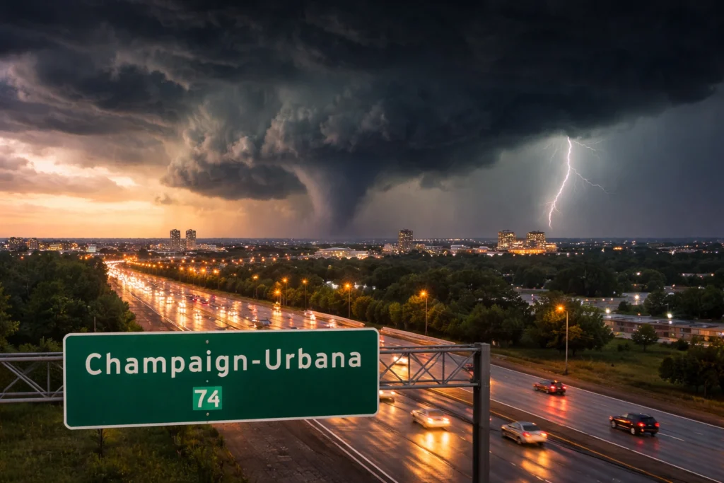
A tornado watch has been issued for Champaign, Urbana and surrounding counties in Illinois as severe storms move toward central and east-central parts of the state, placing communities on high alert for possible tornadoes, damaging winds, hail and localized flooding. The official alert, issued for Friday, April 17, 2026, signals that atmospheric conditions are favorable for dangerous storm development through the evening and overnight hours.
The watch covers multiple counties including Champaign, Clark, Coles, Douglas, Edgar, Cumberland, Piatt and Vermilion. For residents, students, travelers and businesses across the region, the warning period creates immediate concerns over road safety, transport delays and possible service disruptions as storms intensify. Authorities are urging the public to stay alert and monitor official weather updates as conditions evolve quickly.
What a Tornado Watch Means
A tornado watch means conditions are favorable for tornado formation but does not confirm that a tornado has been sighted. It is an early warning designed to give communities time to prepare before storms reach peak intensity.
Weather officials use radar, satellite imagery, atmospheric models and surface observations to determine when ingredients such as instability, moisture and wind shear are strong enough to support rotating thunderstorms. Watches can later be upgraded to tornado warnings if radar detects rotation or a tornado is reported on the ground.
Severe Storm Threats Beyond Tornadoes
The current system is expected to bring multiple hazards across central Illinois. Forecasters warned of damaging straight-line winds that could exceed 70 miles per hour, large hail capable of damaging vehicles and property, and torrential rainfall that may lead to flash flooding.
These threats can be as dangerous as tornadoes in some situations. Strong winds can bring down trees and power lines, hail can create hazardous driving conditions, and flooding can quickly overwhelm roads and low-lying areas. Travelers heading into or out of the Champaign-Urbana area are being advised to check conditions before departure.
Why Illinois Faces Spring Tornado Risk
Central Illinois lies within one of the United States’ most active severe weather corridors during spring. Warm, moist air moving north from the Gulf of Mexico often collides with cooler, drier air from the Plains and upper Midwest, creating an unstable atmosphere favorable for powerful thunderstorms.
When these ingredients combine with strong wind shear, supercell storms can develop. These rotating storms are the most common producers of tornadoes, very large hail and intense wind damage. Spring is historically one of the busiest seasons for severe convective weather across the Midwest.
Travel and University Community Impacts
The Champaign-Urbana region is home to a large university population, major road corridors and frequent regional travel activity. Severe weather during evening hours can affect commuters, campus operations, sporting events, hotel occupancy and local businesses.
Passengers using highways, intercity buses or nearby transport links may experience delays if storms reduce visibility, flood roads or trigger emergency closures. Hospitality providers and event organizers often face last-minute schedule changes when tornado watches are issued.
How Residents and Visitors Should Prepare
Officials recommend identifying a safe shelter location before storms arrive. The best option is usually a basement or an interior room on the lowest floor of a sturdy building, away from windows. Mobile phones should remain charged, and emergency alerts should be enabled.
Visitors staying in hotels or unfamiliar accommodations should locate designated shelter areas in advance. Drivers should avoid unnecessary travel if storms begin to intensify and never attempt to cross flooded roads. Real-time information can be critical when warnings are issued suddenly.
Emergency Alerts and Ongoing Monitoring
Weather alerts are distributed through multiple channels including wireless emergency alerts, NOAA Weather Radio and local emergency management systems. These tools are designed to deliver urgent warnings quickly when conditions worsen.
Meteorologists continue to monitor radar trends and storm development throughout the evening. If thunderstorms strengthen or tornadic rotation is detected, more urgent warnings may follow for specific communities in the watch area.
Outlook for Central Illinois
The tornado watch underscores an active spring weather pattern across the Midwest, where rapidly changing conditions can develop with little notice. For Champaign-Urbana and nearby communities, the priority remains preparedness, timely communication and safety.
Residents and travelers alike should remain vigilant until the storm threat passes. In severe weather events, early action and trusted updates can make the difference between disruption and danger.
For more travel news like this, keep reading Global Travel Wire