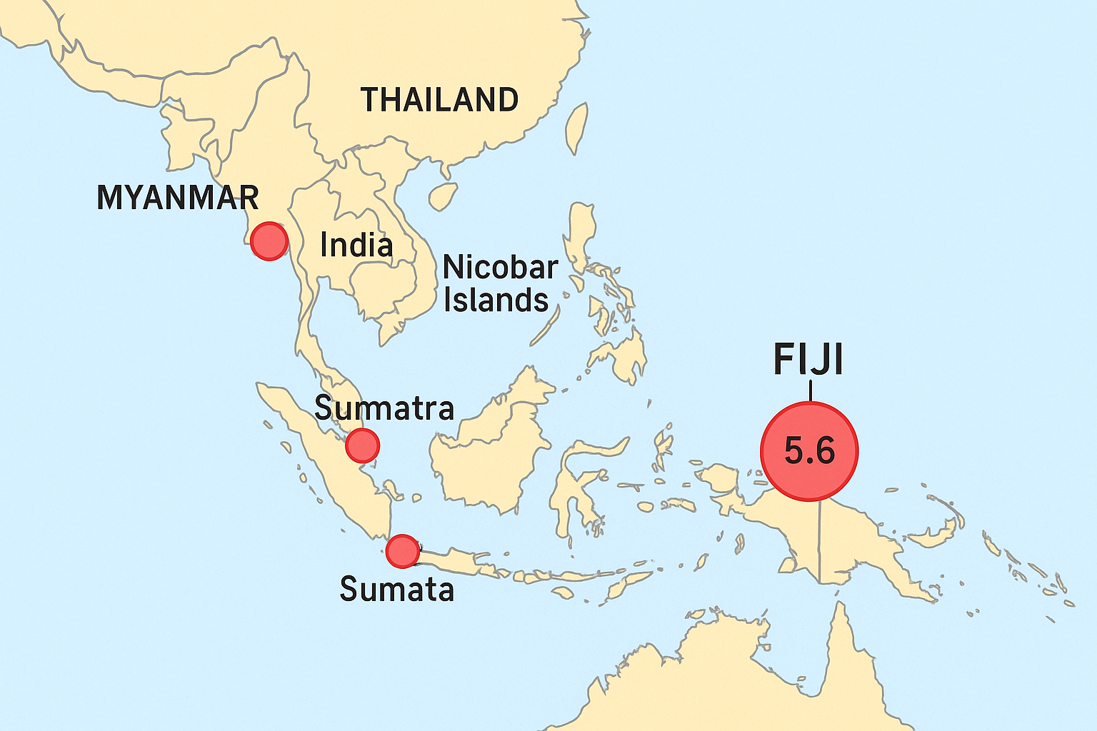
A powerful 5.6 magnitude earthquake struck the Fiji Islands Region early Thursday, raising seismic alerts across the Asia-Pacific. Though remote and deep in the Pacific Ocean, the quake’s occurrence coincided with a chain of smaller tremors felt across Myanmar, India’s Nicobar Islands, and Indonesia’s Northern Sumatra, highlighting the ongoing vulnerability of the region’s tectonic landscape.
According to the United States Geological Survey (USGS) and Thailand’s Earthquake Observation Division, the Fiji quake was recorded at a considerable depth, far offshore, minimizing the risk of tsunamis or damage. However, its timing, coupled with shallow quakes near Southeast Asia’s tectonic boundaries, points to increased seismic stress in the region.
Myanmar Hit by 4.9 Magnitude Quake Near Thai Border
At 7:40 am local time, a 4.9 magnitude earthquake jolted Myanmar, centered approximately 314 kilometers northwest of Thailand’s Mae Hong Son province. Occurring at a depth of 18 kilometers, the tremor did not cause damage but was closely monitored by Thai authorities due to its proximity to border communities.
Given that northern Thailand shares fault lines with Myanmar, particularly near the Sagaing Fault, this area is consistently monitored by regional agencies including Thailand’s Department of Disaster Prevention and Mitigation (DDPM) and Seismological Bureau. No injuries or structural damage were reported, but heightened vigilance was encouraged in border provinces.
Indonesia’s Northern Sumatra Experiences a 4.5 Magnitude Tremor
Just minutes after the Myanmar quake, a 4.5 magnitude tremor struck Northern Sumatra, Indonesia, at 7:43 am, with an epicenter located about 490 kilometers southwest of Phuket, Thailand. Recorded at a depth of 80 kilometers, the quake fell within the deeper seismic zone of the Sunda megathrust, part of the volatile Pacific Ring of Fire.
Sumatra is no stranger to seismic activity. Historical data from Indonesia’s Meteorology, Climatology, and Geophysical Agency (BMKG) indicates that this region frequently experiences tectonic shifts capable of generating both earthquakes and tsunamis. While no tsunami warning was issued, the Indonesian authorities continue to evaluate aftershock probabilities.
Twin Earthquakes Shake India’s Nicobar Islands
India’s Nicobar Islands, located near the Andaman Trench, also recorded two tremors on Thursday. The first struck at 4:42 am, registering 4.1 in magnitude at a shallow depth of 10 kilometers. A second, slightly weaker quake followed soon after. Both events were recorded approximately 478 kilometers northeast of Thailand’s Phang Nga province.
These islands sit on the subduction zone between the Indian and Burma plates, known for triggering deadly seismic events like the 2004 Indian Ocean tsunami. The India Meteorological Department (IMD) and National Centre for Seismology (NCS) confirmed that the twin quakes posed no immediate tsunami risk but reaffirmed the area’s vulnerability.
Thailand Remains on Alert Despite No Direct Impact
Though Thailand did not experience any tremors directly, its Earthquake Observation Division, under the Thai Meteorological Department, remains on high alert. Officials confirmed that no tremors were felt in the kingdom, and no damage or injury reports have surfaced.
However, provinces like Phuket, Phang Nga, and Mae Hong Son are considered at-risk due to proximity to active fault zones in Myanmar, Sumatra, and the Andaman Sea. DDPM has asked residents in these areas to remain vigilant and report any signs of seismic activity.
Scientific Context: Asia-Pacific’s Tectonic Volatility
The recent cluster of seismic events underscores the geological instability across the Asia-Pacific, particularly in zones surrounding the Indian Ocean and Pacific Plate boundaries. Experts from the Asian Disaster Preparedness Center (ADPC) and International Seismological Centre (ISC) believe the activity may be a result of plate stress accumulation rather than a singular triggering event.
Fiji’s offshore quake, although unrelated geophysically to the Southeast Asian tremors, occurred in the Pacific Ring of Fire, a zone responsible for 90% of the world’s earthquakes. In contrast, Southeast Asia lies on the complex collision boundaries of the Eurasian, Indo-Australian, and Philippine Sea Plates, making it highly susceptible to earthquake activity.
Regional Preparedness and International Cooperation
Authorities across Southeast Asia are strengthening early warning systems, earthquake response protocols, and cross-border data sharing to better manage such geological events. Thailand’s DDPM collaborates with international organizations like ASEAN’s Coordinating Centre for Humanitarian Assistance (AHA Centre) and UNDRR to improve readiness.
Modern advancements such as the ASEAN Earthquake Information Center (AEIC), AI-driven risk mapping, and real-time seismic data from global platforms like IRIS and GEOFON have greatly improved forecasting accuracy and public awareness campaigns.
Conclusion: Resilience Through Readiness
The events of Thursday demonstrate the fragile tectonic balance in Southeast Asia and the South Pacific. While no casualties or major damage were reported, the clustering of seismic events in a short time frame reinforces the need for continuous earthquake education, preparedness, and infrastructure resilience.
As natural forces continue to shape the planet’s surface, communities across this seismically active belt must remain vigilant. Governments and citizens alike must treat every tremor as a reminder of nature’s unpredictability and the value of science, communication, and regional cooperation.
For more travel news like this, keep reading Global Travel Wire