The United Kingdom is bracing for a turbulent weekend as severe storms bring widespread flood alerts, strong winds, and heavy rainfall across England, Wales, Scotland, and parts of Northern Ireland. For both residents and tourists, the unsettled conditions are expected to cause major travel disruption, particularly in coastal regions, the Lake District, and upland areas where rainfall totals could exceed 80mm. With weather warnings in place, those planning journeys are urged to prepare for delays, possible cancellations, and sudden road closures.
Yellow Weather Warnings in Place
The Met Office has issued multiple yellow weather warnings for both rain and wind. The warnings extend from Saturday morning into the early hours of Sunday, with the most intense conditions expected in western and northern regions. Gusts of up to 75mph are predicted along coastal areas such as West Wales, the Bristol Channel, and the eastern seaboard of England, raising concerns about flying debris, power outages, and dangerous travel conditions. Inland regions will also experience strong winds, with speeds between 50 and 60mph.
For tourists visiting the UK this weekend, this could mean delays across multiple modes of transport. Maritime services are at particular risk of cancellation due to the high winds, while train operators and airlines have already warned of potential timetable changes. Motorists are being advised to avoid non-essential travel in affected regions.
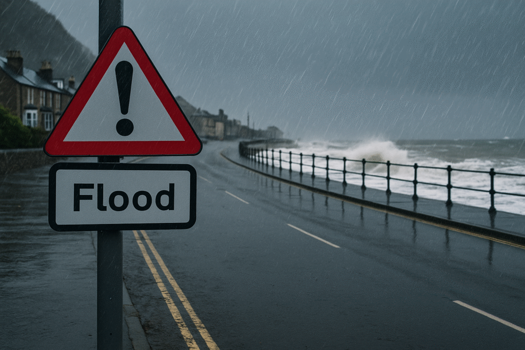
Flood Alerts Across the Nations
As of Saturday, more than 40 flood alerts are active in England, with over 20 in Wales. Scotland and Northern Ireland are also preparing for hazardous conditions.
In England, the Lake District continues to see high lake levels, especially around Keswick Campsite, where flooding is expected to persist. Rivers such as the Eden, Churnet, Tean, and Dee are at risk of overflowing, and areas of Norfolk face potential tidal surges.
In Wales, the north-west coastlines, Conwy, Dyfi, Dysynni, and Severn catchments are under close monitoring. Popular destinations such as the Gower Peninsula and Llanelli may see temporary road closures and disruption to local services.
Scotland is forecast to receive some of the heaviest rainfall, with Dumfries and Galloway, East Lothian, and the Scottish Borders under severe risk of flooding. Up to 80mm of rain may fall in just a few hours, bringing the threat of road blockages, swollen rivers, and power cuts.
Northern Ireland has not escaped the storm’s impact either, with counties Down and Antrim expected to receive over 100mm of rainfall in higher ground areas, leading to spot flooding and travel delays.
Temperature Drop After Summer Warmth
The storm comes as a dramatic contrast to the warm conditions experienced earlier in the week. London saw highs of 27.8°C on Friday, but by Sunday, temperatures could plummet to just 8°C in some areas. This sudden shift marks the arrival of a cold front that will bring cooler, wetter, and windier weather across the UK.
Met Office forecasters stress that this sharp change could increase the likelihood of flooding, as urban drainage systems struggle to cope with intense bursts of rainfall following dry, warm periods.
Impact on Tourism and Travel
For the UK’s tourism sector, the timing of this stormy spell could not be more disruptive. Many visitors travel to rural hotspots such as the Lake District, the Welsh coast, and Scotland’s border regions during September, drawn by late-summer events and scenic landscapes. Unfortunately, these are precisely the regions most affected by flood alerts and severe weather warnings.
Tourists planning hikes, camping, or countryside tours should be aware that certain routes may become impassable, and popular attractions could close temporarily. Local businesses, including hotels, bed and breakfasts, and restaurants, are preparing for cancellations and reduced footfall. Travel operators have encouraged flexibility in booking arrangements and strongly advise checking the latest weather updates before setting out.
Safety Precautions and Government Advice
Authorities across the UK are activating flood response plans. Local councils are distributing sandbags, monitoring river levels, and preparing emergency shelters in vulnerable communities. Residents and visitors alike are urged to follow official advice, which includes:
- Avoiding coastal paths, clifftops, and riverbanks during the storm.
- Securing outdoor furniture and loose items that may become dangerous in high winds.
- Reconsidering non-essential travel to flood-prone regions.
- Staying indoors during peak storm hours, particularly overnight when conditions are most hazardous.
Emergency services have also warned about the increased risk of road accidents due to surface water and falling trees. Power companies are on standby for outages, with engineers ready to respond to broken lines and damaged infrastructure.
What to Expect Beyond the Weekend
Meteorologists expect the worst of the storm to clear into the North Sea by Sunday morning. However, unsettled weather will likely persist into early next week, with more showers and blustery conditions across much of the country. Coastal areas may continue to face disruption, particularly for ferry services and rural road networks.
The storm is part of a wider pattern of unpredictable autumn weather across Europe, highlighting the increasing variability of seasonal conditions. For travellers planning to visit the UK in the coming weeks, staying updated with official weather forecasts remains essential.
Final Word
While the stormy weekend will test both locals and tourists, being prepared and flexible is the key to staying safe. The UK remains an attractive destination with a wealth of cultural, historical, and natural experiences to offer. Visitors should plan carefully, take sensible precautions, and adjust itineraries to ensure they enjoy their travels while avoiding unnecessary risks during this period of unsettled weather.
For more travel news like this, keep reading Global Travel Wire