A sudden and intense tornado warning swept across the U.S. capital and its neighboring Maryland counties on the evening of July 9, sparking widespread fear, emergency responses, and a citywide scramble for shelter. The storm, exhibiting tornadic rotation on Doppler radar, sent meteorologists, emergency officials, and residents into high alert as it barreled northeast at 25 miles per hour.
The National Weather Service (NWS) issued a tornado warning at 6:42 p.m. for the District of Columbia, Montgomery County, and Prince George’s County, following radar-confirmed rotational patterns near Howard University. The alert urged immediate protective action as the storm showed signs consistent with tornado formation, including a hook echo—a classic radar signature.
Communities from Takoma Park and Silver Spring to Mount Rainier and Hyattsville were instructed to shelter in place. Residents were advised to move to the lowest interior rooms of their homes or basements, away from windows and glass.
Torrential Rain, Lightning, and Widespread Disruption
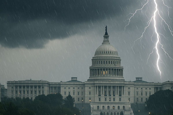
As the supercell storm struck the urban core, skies darkened abruptly. Visibility dropped to near zero with torrential rain and wind gusts shaking trees and ripping branches from their trunks. Flash flooding occurred in several low-lying neighborhoods, stranding motorists and pedestrians.
Iconic government buildings including the White House, U.S. Capitol, and National Mall were caught in the downpour. Emergency services and U.S. Park Police quickly moved to clear tourists and pedestrians from open areas. Live news footage showed lightning illuminating the Washington Monument through blinding sheets of rain.
Eyewitnesses in northeast Washington and Chillum reported hearing the distinctive roaring sound often associated with a tornado’s approach. Though no funnel cloud was confirmed to have touched down, the fear of an imminent strike led many residents to seek safety in basements and emergency shelters.
Montgomery and Prince George’s Counties on High Alert
Montgomery County officials, in coordination with the Maryland Emergency Management Agency (MEMA), activated local sirens, sent emergency alerts to cellphones, and deployed first responders to high-risk zones. Silver Spring and Wheaton neighborhoods faced heavy rainfall and wind gusts exceeding 60 mph.
Meanwhile, Prince George’s County pre-positioned emergency crews and utility workers in anticipation of widespread outages and road blockages. Power crews reported isolated electrical disruptions in Hyattsville and Mount Rainier due to falling tree limbs and flooded substations. Emergency departments at local hospitals were placed on standby.
Community centers in Takoma Park, Langley Park, and College Park were opened as temporary storm shelters for residents without access to basements or sturdy housing. Volunteers and emergency responders assisted the elderly and disabled in relocating to safer areas.
Storm Formation and Meteorological Analysis
Meteorologists at the NWS explained the storm’s development was triggered by a confluence of hot, moist air over the Potomac River basin and a strong cold front advancing from the west. The resulting instability led to severe thunderstorm formation, initially under a watch issued earlier that afternoon.
As atmospheric pressure dropped and storm rotation intensified, conditions for tornado development became increasingly favorable. The storm’s moderate speed and northeastward trajectory meant it impacted multiple population centers, posing risks not only from tornadic winds but also from localized flooding and infrastructure strain.
According to the NWS, rotational signatures were most pronounced over Mount Rainier and Chillum. These areas saw sudden bursts of strong winds, hail, and debris, but as of the latest update, no confirmed tornado touchdown occurred.
Transport Delays and Airport Disruptions
Transportation systems across the capital came to a halt. WMATA Metro rail services experienced delays and partial line suspensions due to water intrusion and debris. Bus routes were rerouted or canceled entirely, and major roadways were clogged with stranded vehicles and floodwaters.
Flights at Ronald Reagan Washington National Airport were temporarily delayed or diverted. The Federal Aviation Administration (FAA) instituted temporary ground stops due to poor visibility and lightning activity in the vicinity of air traffic control infrastructure.
Emergency Coordination and Community Response
Post-storm assessments were quickly initiated by municipal authorities. Drone footage was used to survey impacted neighborhoods, checking for structural damage, fallen power lines, and road obstructions. Fire departments in all three jurisdictions reported high call volumes related to downed trees, minor flooding incidents, and non-life-threatening injuries.
Despite widespread disruption, the region was fortunate to avoid a direct tornado touchdown. Officials warned, however, that the conditions seen could easily have resulted in greater catastrophe. Flash flood warnings remained active for hours after the storm moved northeast into less populated regions.
A Wake-Up Call for Urban Climate Resilience
This latest severe weather episode highlights the growing challenges cities like Washington D.C. face in an era of intensifying climate events. Urban planners and emergency management agencies are expected to evaluate the incident to improve preparedness, especially in dense neighborhoods vulnerable to flooding and infrastructure strain.
Federal officials emphasized the importance of maintaining situational awareness during summer months and heeding early warning systems. The District’s Office of Resilience and local emergency management departments reiterated calls for residents to have emergency kits, communication plans, and knowledge of the nearest shelters.
Conclusion:
While the storm ultimately spared the D.C. region from the worst, the tornado warning served as a stark reminder of nature’s unpredictability and the need for constant vigilance. In the face of rising climate threats, D.C. and surrounding counties are urged to prioritize community preparedness, infrastructure resilience, and public awareness for the challenges ahead.
For more travel news like this, keep reading Global Travel Wire


