Ireland is bracing for an intense Arctic cold spell as freezing air pushes southward, bringing sharp temperature drops, icy roads, and widespread travel disruption. Met Éireann has issued fresh Snow and Ice Warnings for several northern and western counties, with temperatures expected to fall as low as -8°C in some sheltered areas. The national forecaster has urged people to stay alert as conditions worsen through the week.
The Arctic air mass moved in from northern latitudes earlier this week and continues to strengthen. The cold snap will hold firm, affecting daily routines, transport, and outdoor activity across the country. Authorities have activated winter plans and called for extra care during commutes.
Cold Air Spreads Across Europe
The Arctic mass has expanded across western Europe, creating colder-than-usual conditions from Scandinavia to the Mediterranean. Ireland sits on the frontline of this icy plunge, with northern and western areas feeling the earliest impact. Counties such as Donegal, Sligo, Leitrim, Cavan, and Monaghan are the most affected so far.
Daytime temperatures remain low, and nights are turning extremely cold. Frost is forming early, and icy stretches are becoming more common on rural and untreated roads. Met Éireann has advised residents to stay updated as temperatures may drop suddenly after sunset.
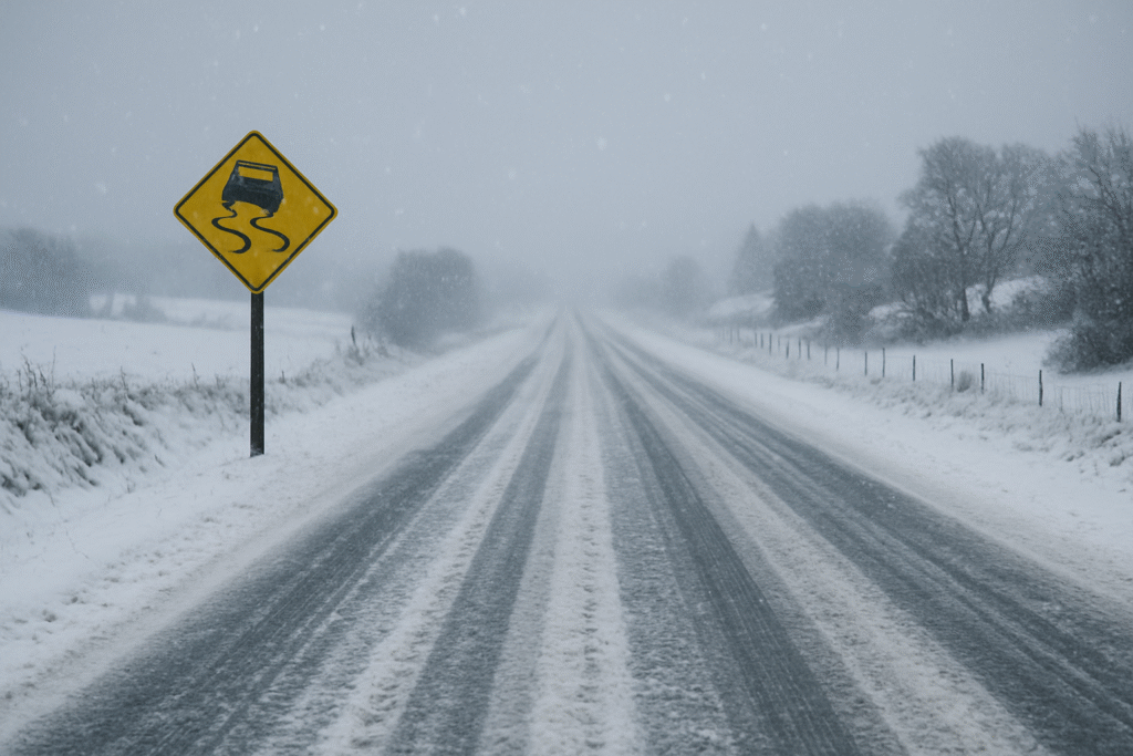
Snow and Ice Warnings in Effect
Snow showers have already developed in parts of Ulster and Connacht, and forecasters expect conditions to deteriorate further. The Snow and Ice Warning highlights the risk of slippery roads, reduced visibility, and freezing fog patches. Higher ground may see deeper accumulations, while lowland areas will face icy surfaces even after brief snowfall.
The public has been asked to plan ahead and leave extra time for essential journeys. Transport delays are likely, particularly during early morning and evening travel peaks. Local authorities are deploying gritting trucks, but the sharp overnight freeze may limit their effectiveness on smaller routes.
What To Expect Through the Week
Cold but bright spells are expected on Thursday, with occasional wintry showers in northern regions. Daytime temperatures will range between 3°C and 7°C, but the northerly wind will make it feel much colder. Clear skies at night will allow temperatures to fall sharply, with widespread frost expected.
Thursday night may see lows of -3°C to 0°C. Light winds will increase the wind-chill effect, making conditions feel more severe. Cloud cover will build from the west towards morning, but the east will remain bitterly cold before dawn.
Friday will bring a temporary shift as cloud increases and rain begins along Atlantic counties. Rainfall may intensify through the afternoon, spreading inland and creating hazardous conditions when mixed with leftover frost. Temperatures may rise slightly, reaching 5°C to 9°C, but the improvement will be brief.
Friday night will see heavy rain, drizzle, and falling temperatures. Western and coastal regions may experience flooding risks due to rainfall meeting frozen ground. The mix of wet and cold may also lead to rapid ice formation on untreated surfaces.
Impact on Daily Life and Travel
The Arctic snap is already proving disruptive. Black ice is becoming a major hazard, catching drivers off-guard in shaded and rural areas. Pedestrians are also at risk due to slippery pavements and footpaths.
Motorists are urged to reduce speed, maintain longer stopping distances, and ensure vehicles are winter-ready. This includes checking tyres, wipers, lights, and antifreeze levels. Public transport may face delays, especially early in the day when icy surfaces are most severe. Flight schedules could also be impacted by low visibility or snow accumulation.
Schools and community facilities are monitoring conditions closely. Salt bins, grit supplies, and emergency support systems are being used more frequently as temperatures continue to drop. Vulnerable individuals, including older adults and those with health concerns, are advised to take extra precautions.
Weekend and Long-Range Outlook
Cold and unsettled weather is expected through the weekend and into next week. Wintry showers may develop again, especially in northern and western regions. Some eastern counties could also see snowfall if winds shift slightly.
The persistent Arctic flow means temperatures will stay below average for several days. Nights will remain freezing, and frost could become severe in sheltered inland areas. Agricultural communities may see challenges due to the freezing of water supplies and risks to early crops.
Forecasters note that the colder-than-usual pattern may continue into the following week. Further warnings are likely if snow showers intensify or if ice becomes more widespread.
Staying Prepared During the Arctic Cold Snap
Ireland’s Arctic blast is set to continue bringing challenging conditions. Staying prepared is essential. Simple steps such as monitoring weather updates, planning travel carefully, and checking heating systems can help reduce risks.
Met Éireann will continue to issue updates as the situation evolves. Authorities encourage everyone to stay vigilant, look out for vulnerable neighbours, and take extra care on icy roads and footpaths.
As Ireland navigates this period of extreme winter weather, preparation and caution remain key to staying safe throughout the cold spell.
For more travel news like this, keep reading Global Travel Wire