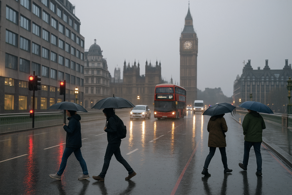
A turbulent weather weekend has unfolded across London and the South East, with heavy rain, strong winds and rising flood risks affecting holidaymakers and commuters alike. What many hoped would be a calm late-November getaway has turned into a test of patience as travel disruption spreads across major routes, coastal towns and countryside retreats.
The Met Office has issued Yellow weather warnings for heavy rain across much of the region. Although these alerts are the lowest tier of the national warning system, they still signal a credible risk of flooding, delays and hazardous travel conditions.
Fast-Changing Weather Across the Region
Saturday opened with steady rain across London, with temperatures around 11°C but feeling cooler due to brisk winds. Light to moderate rain dominated the morning, easing into scattered showers by midday. Rain chances dropped later, but small pockets of drizzle remained possible into the evening.
This wet spell forms part of a wider Atlantic system moving through southern England. As moist air meets cooler conditions, persistent rainfall develops, especially over higher ground such as the South Downs and the elevated areas of Surrey and Kent. These zones often see heavier downpours due to orographic lift — when air is forced upwards over hills, increasing rainfall intensity.
Who Is Most Affected?
The Yellow warning covers London, Brighton & Hove, Portsmouth, Southampton, Kent, Surrey and parts of East and West Sussex. Coastal districts and low-lying river valleys remain especially vulnerable to surface water flooding.
Travellers heading to coastal hubs such as Brighton, Portsmouth and Southampton should prepare for slower journeys and potential route diversions. Ferry ports may face delays during periods of strong onshore winds. Rail routes running through flood-prone stretches of Surrey, Sussex and Hampshire may also see temporary speed restrictions or suspension if water pools on the tracks.
When the Weather Turned — And What Comes Next
Saturday’s warning stays in place through the day, with around 5 mm of rainfall expected across much of the South East. Sunday brings a break in the weather, offering brighter skies and only a small chance of late-evening showers.
But the improvement will be short-lived. A new frontal system arrives on Monday evening and continues into Tuesday. This next spell is expected to be more intense, with widespread totals of 20–30 mm of rain and up to 60 mm on higher terrain. Coastal winds may strengthen toward gale force, particularly along exposed shorelines.
Travel Impact — What Visitors and Commuters Should Expect
Road Travel
Drivers face slippery surfaces, reduced visibility and pockets of standing water. Coastal routes and roads near rivers are at a higher risk of temporary flooding. Motorists should reduce speed, allow extra stopping distance and avoid driving into waterlogged stretches.
Public Transport
Trains may experience delays where tracks pass through embankments or flood-susceptible areas. Bus routes could be diverted or delayed. Ferry crossings — including services between Portsmouth, Southampton and the Isle of Wight — may run reduced schedules if winds increase or harbour areas become unsafe.
Weekend Breaks and Day Trips
Short breaks to beaches, countryside paths or coastal towns may be disrupted. Even after rain decreases, large puddles and delayed services may affect arrival times or lead to last-minute cancellations.
Early Week Commuting
Monday and Tuesday could bring the most significant travel challenges. Anyone travelling into London or coastal workplaces should prepare for longer journeys, unexpected closures and potential flooding along main road arteries.
Why These Warnings Matter
Late autumn weather patterns frequently bring complex, fast-moving Atlantic systems toward the UK. These systems carry warm, moisture-rich air that can trigger prolonged rainfall when meeting cooler regional air. Repeated rain events over several days also saturate the ground, reducing the soil’s ability to absorb new rainfall and increasing surface runoff.
Although this weekend’s system is not as severe as earlier storms this month, its timing and duration make it disruptive. Combined rain and wind can strain transport networks, especially in coastal and low-lying districts.
Official Advice — Stay Alert and Travel Smart
A Yellow warning encourages people to stay aware of changing conditions. The guidance stresses planning, flexibility and safe decision-making. Key steps include:
- Check live route updates before setting out.
- Delay non-essential journeys during peak rainfall.
- Drive slowly, use headlights and avoid flooded roads.
- Choose inland routes over coastal ones where possible.
- Keep plans flexible from Sunday through Tuesday.
Forecast Snapshot
- Saturday: Persistent morning rain easing to showers. Around 5 mm of rainfall.
- Sunday: Brighter and mostly dry with only a small chance of late drizzle.
- Monday: Rain increasing late afternoon, becoming heavy overnight.
- Tuesday: Rain easing to scattered showers. Sunny spells emerging later.
- Midweek: Mix of cloud, drizzle and brighter breaks.
Final Word — Plan Carefully or Postpone
If you plan to travel from London to Portsmouth, Brighton, Southampton, Kent or any South East destination, consider delaying your trip or allowing extra time. Essential travellers should take extra care, stay informed and prepare for changes.
With rain, wind and wet roads across the region, this weekend may be better suited to indoor plans until conditions improve.
For more travel news like this, keep reading Global Travel Wire


