WASHINGTON D.C. – JULY 13, 2025 – Travelers in and around Washington D.C. are grappling with severe weather-related disruptions as a dangerous combination of intense heat, torrential rain, and thunderstormscontinues to affect the region. The heat index is soaring, flooding has been reported in multiple locations, and both ground and air transportation have seen significant delays.
With a Heat Alert in effect through Sunday and localized flood warnings still active in Fairfax County, Virginia, tourism plans and transit operations have been thrown into disarray. Travelers heading to or out of the nation’s capital this weekend are urged to monitor weather advisories, plan for delays, and take safety precautions amid the extreme conditions.
Flash Flooding and Power Outages Disrupt Northern Virginia
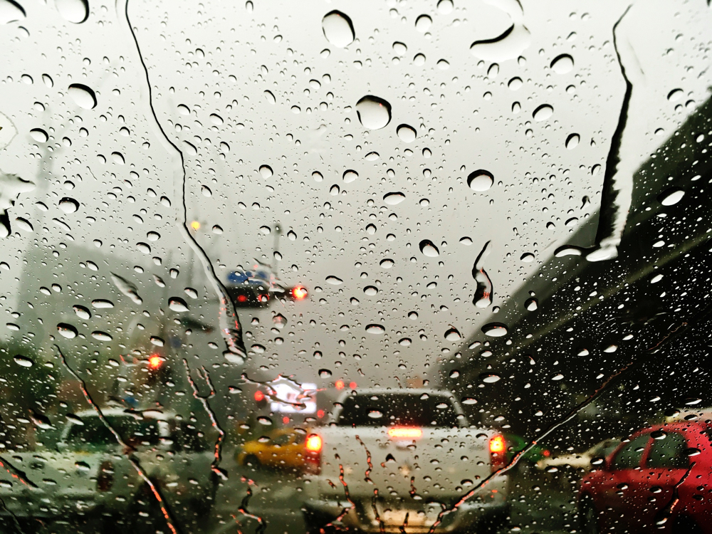
The heavy rainstorms that swept through the D.C. metropolitan area late Saturday triggered flash flooding in low-lying parts of Fairfax County, including Reston, Vienna, and the Tysons Corner area. Roads were submerged within minutes, leaving cars stranded and traffic immobilized.
According to Dominion Energy, over 500 customers in Fairfax County remained without power as of early Sunday morning. Although neighboring Montgomery County, Maryland, saw fewer outages, many businesses and hotels struggled with intermittent blackouts—further complicating stays for tourists.
Streams and creeks across the region remain swollen, and standing water still impacts key roadways. Meteorologists have warned that full drainage may take additional time, especially in flood-prone zones.
Travel Disruptions: Public Transit, Roads, and Flights Affected
Travelers using Washington Metro services should expect delays and potential schedule changes. The region’s bus and rail systems are vulnerable to weather-induced delays, particularly during thunderstorms and periods of poor visibility. The Washington Metropolitan Area Transit Authority (WMATA) is providing real-time service updates via its website and mobile app.
For air travelers, Ronald Reagan Washington National Airport (DCA) and Dulles International Airport (IAD)reported weather-related delays and scattered cancellations, especially for afternoon and evening flights. Fog and reduced visibility are expected to impact arrivals and departures, so passengers are advised to check flight statusfrequently and arrive early.
Driving is also risky, especially in flood-affected zones. Local authorities continue to urge motorists to avoid driving through standing water and to follow alternate routes when flooding is present. Roads in Reston and Vienna remain partially blocked, and conditions may worsen with additional rainfall forecasted.
Extreme Heat Raises Health Concerns for Tourists
The oppressive humidity in D.C. is making already high temperatures feel 5 to 10 degrees hotter, with the heat index reaching into the mid-90s Fahrenheit. A Heat Alert remains in place through Sunday morning.
Tourists visiting outdoor landmarks like the National Mall, Smithsonian museums, and Memorial Parks are encouraged to take precautions against heat-related illnesses. Authorities recommend:
- Staying hydrated with water bottles on hand
- Wearing light, breathable clothing
- Avoiding peak heat hours (1–5 PM)
- Taking breaks indoors or in shaded areas
For those without air conditioning or seeking relief, the District of Columbia government has opened multiple cooling centers. A complete list and an interactive map are available at dc.gov.
Forecast for the Week Ahead
Meteorologists from 7News DC and the National Weather Service expect scattered thunderstorms to continue through Sunday and Monday, with some systems bringing torrential rain and gusty winds. Afternoon storms may be slow-moving and “pack a punch,” according to 7News meteorologist Matt Ritter.
- Monday: Highs near 90°F with afternoon storms possible
- Tuesday: Slightly cooler, highs in the upper 80s, but patchy thunderstorms remain in the forecast
- Wednesday: Brief respite with partly cloudy skies and temperatures near seasonal averages
Travelers should prepare for intermittent delays and remain alert for flash flood warnings and airport advisoriesthroughout the first half of the week.
Quick Travel Tips for Washington D.C. Visitors This Weekend
- Check Weather and Transit Updates Regularly: Use the National Weather Service, WMATA, and airline apps for the latest alerts.
- Avoid Flooded Roads: Never attempt to drive through standing water. Use apps like Waze and Google Maps to find detours.
- Use Cooling Centers: Free to access and open citywide, these centers provide air-conditioned spaces to escape the heat.
- Travel Light and Smart: Carry water, umbrellas, or ponchos. Dress in moisture-wicking clothing and wear sunscreen.
- Arrive Early at Airports: Weather-related backups could slow down TSA checkpoints and baggage processing.
What to Expect for the Remainder of the Week
While Sunday and Monday are expected to remain hot and stormy, a slight improvement is forecast by Tuesday. However, temperatures will remain in the high 80s to low 90s, and humidity levels will remain elevated, sustaining the heat discomfort index.
Travelers should plan ahead, stay informed, and consider indoor attractions such as the National Museum of American History, United States Capitol tours, or Smithsonian Air and Space Museum if weather worsens.
For real-time updates on weather, flood warnings, and cooling centers, visit:
For more travel news like this, keep reading Global Travel Wire