Colorado is bracing for a powerful winter storm that will reshape travel plans across its high country. Heavy snow, strong winds, and rising avalanche risks will create dangerous conditions for skiers, hikers, and road travelers. Multiple winter advisories and storm warnings cover the mountains as snowfall intensifies through the weekend. Travelers should expect delays and shifting conditions as fresh snow blankets the region.
Rapid Weather Shift Across the Rockies
Winter weather will strengthen overnight as cold air and moisture sweep into the mountains. Snow begins around midnight in the Elkhead and Park Mountains and spreads across Rabbit Ears Pass and the Continental Divide by sunrise. Wind gusts will reach 45–55 mph in exposed mountain corridors. Visibility will drop quickly during peak snowfall, making travel difficult.
Temperatures stay cold through Friday morning, dipping into the teens and 20s in many western valleys. Daytime highs will reach only the 30s across mountain towns. This sharp cool-down sets the stage for deep snow totals and icy conditions on major routes.
Snowfall Expectations Across Key Mountain Areas
Winter Weather Advisories are in effect for several ranges, each expecting moderate to heavy snow. The Elkhead and Park Mountains will see 4–8 inches through Friday evening. Rabbit Ears Pass may receive higher amounts, with snow intensifying after midnight and continuing through late Friday.
A broader round of snow arrives Friday night. The Upper Yampa River Basin is forecast to receive 4–12 inches through Saturday. The Central Colorado River Basin, Grand and Battlement Mesas, and parts of Lake County may see between 3–9 inches. Higher elevations could exceed these amounts.
Conditions will worsen as Winter Storm Warnings activate Friday evening. These warnings signal the most hazardous period of the storm. Snowfall in the Flat Tops, Gore Range, Elk Mountains, and Central Mountain Valleys may reach 6–20 inches. Strong winds will create blowing snow and drifting, especially near high passes.
A second wave of warnings follows late Friday night. The West Elk Mountains, Sawatch Range, Summit County mountains, Mosquito Range, and Indian Peaks may see 6–14 inches, with isolated pockets near Rabbit Ears Pass approaching 24 inches. Gusts near 55 mph will heighten the danger for anyone traveling through these areas.
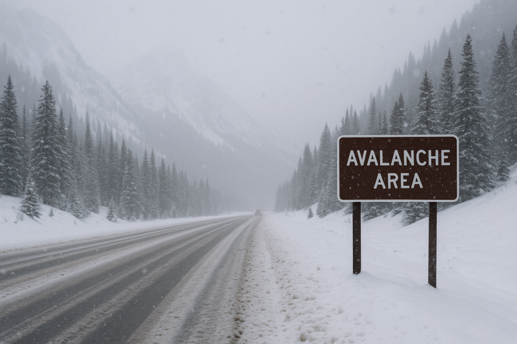
Avalanche Risk Rising in Backcountry Zones
An Avalanche Watch covers the Park Range and surrounding slopes. Heavy snowfall and strong winds will produce unstable layers on steep terrain. Backcountry travelers face high risks, especially on wind-loaded slopes. Conditions may shift quickly as new snow accumulates. Visitors should avoid avalanche-prone areas and stay within managed ski resort boundaries whenever possible.
Avalanche safety gear, knowledge, and real-time updates are essential for anyone entering ungroomed terrain during this storm cycle.
Timing the Storm: What Travelers Should Expect
Snow begins late tonight and spreads southeast across mountain corridors by dawn Friday. The heaviest snowfall arrives Friday evening and lasts through early Saturday. Travel conditions will worsen rapidly after nightfall, especially on high routes such as:
- Rabbit Ears Pass
- Vail Pass
- Monarch Pass
- Berthoud Pass
Snow tapers in the mountains late Saturday afternoon. However, light snow may continue in some valleys through Saturday morning and again in the evening.
Expect shifting conditions, sudden road closures, and longer drive times throughout the storm window.
Travel Conditions and Temperature Outlook
Friday morning will start cold with lows in the teens and 20s across western Colorado. Cortez will be among the coldest, near 11°F. Midday temperatures rise slightly into the 30s but remain below freezing in many mountain areas. Wind chills will make conditions feel even colder.
By evening, temperatures drop again as snow intensifies. Ice patches may form on shaded roads, bridges, and mountain tunnels.
How the Storm Impacts Skiers and Travelers
Ski resorts may benefit from deep new snow, but reaching them will be challenging. Road crews will work continuously, yet snow rates may outpace plowing during peak hours. Chairlift delays or closures are possible during strong wind periods.
Those driving to ski areas should leave early, pack warm layers, and prepare for slow progress. Parking lots may fill quickly on powder days, so early arrival is recommended.
Safety Tips for Mountain Travel
Visitors should plan ahead and stay flexible. Here are key safety reminders:
- Use winter tires or chains on all mountain routes.
- Keep extra blankets, food, water, and a flashlight in your vehicle.
- Check Colorado road condition updates before departing.
- Avoid backcountry zones during the Avalanche Watch period.
- Carry avalanche beacons, shovels, and probes if entering unmanaged terrain.
- Allow extra travel time and prepare for rerouted or closed roads.
Weather can vary widely between valleys and peaks, so continuous monitoring is essential.
A Challenging but Beautiful Winter Weekend Ahead
Colorado’s mountains will transform into a winter wonderland as this storm unfolds. Deep snow, colder temperatures, and gusty winds will reshape the landscape. With preparation and awareness, travelers can still enjoy the state’s scenic beauty and world-famous winter recreation. Stay informed, adjust plans as conditions change, and make safety your top priority as Colorado enters a powerful stretch of winter weather.
For more travel news like this, keep reading Global Travel Wire