Tourism hotspots across the United Kingdom are set to face turbulent weather this week. The national forecast signals widespread rain, strong winds and hill snow that could reshape travel plans from Cornwall to the Scottish Highlands. The outlook affects holidaymakers, outdoor enthusiasts and tour operators during what is normally a busy winter tourism period.
Weather systems moving in from the Atlantic are expected to dominate the week. The Met Office has highlighted the potential for unsettled conditions across most of the country. Travellers should prepare for rapidly changing scenarios, especially at higher elevations and coastal areas.
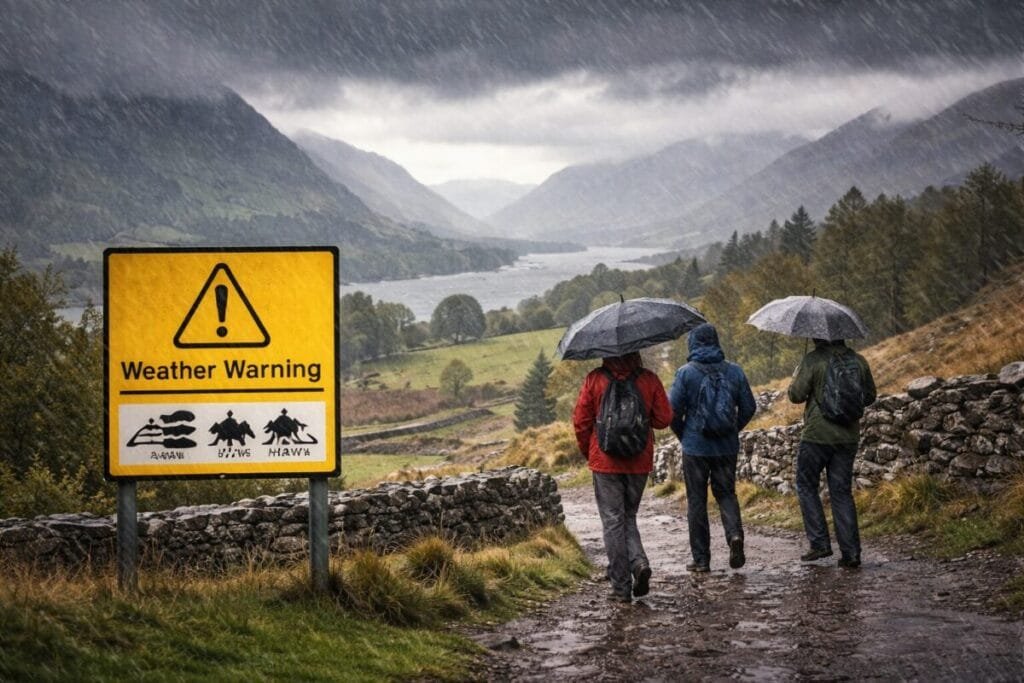
Rain and Wind to Set the Tone
The week began with a band of rain pushing northwards and fog forming in some central regions. Southwestern counties experienced gusty winds, with further strengthening expected as the next weather front moves in.
Tuesday brings a surge of wet and windy conditions across western and southwestern areas. Coastal and upland zones may see gale-force gusts. Rainfall amounts could become significant in parts of Wales and northwest England, increasing risks for walkers and drivers.
The midweek pattern keeps the theme of thick cloud, persistent drizzle and strong breezes. Northern England and Scotland face the added concern of hill snow. The colder air will allow snow to accumulate on higher terrain later in the week.
Tourist Destinations Likely to Feel the Impact
Several iconic British tourist locations could face challenging conditions:
Lake District
Heavy rain and snow at higher levels may affect popular hiking routes. Trails around Helvellyn, Scafell Pike and Fairfield may become slippery and hazardous.
Snowdonia National Park
Rapid shifts in weather are common here. Visitors can expect sharp temperature drops and snow on peaks above 800 metres.
Peak District
Persistent rain may turn to sleet and snow on upland sections. Roads between towns and reservoirs could experience reduced visibility.
Scottish Highlands
Winter hazards increase later in the week with colder winds and accumulating snow. Tourism operators report regular inquiries about closures and access.
Cornwall and Devon
Wind warnings highlight risks to coastal paths and promenades. Large waves could impact beaches and harbour areas popular with visitors.
These locations frequently attract hikers, cyclists and overseas tourists. Many are unprepared for abrupt winter transitions. Tourism boards advise monitoring local guidance and adjusting plans as needed.
Official Warnings and Public Advice
Yellow warnings for wind and rain remain in force across several regions. These alerts indicate possible travel disruption, power interruptions and delays to road, rail, air and ferry services.
Wind gusts in exposed areas may reach 60 to 65 mph. Such speeds can affect high sided vehicles, coastal drives and rural bus services. Rail operators often reduce speeds during strong gusts to protect infrastructure, leading to delays.
Airports in regional hubs such as Exeter, Bristol, Manchester and Glasgow may experience operational disruptions. Ferry companies operating across the Irish Sea and Scottish islands are also monitoring sea states.
Travel Disruption for Visitors
Tourists travelling across the UK should plan for:
- Slippery roads and reduced braking distances
- Flight and rail schedule changes
- Bus route diversions in coastal and high-wind zones
- Ferry cancellations during rough seas
- Delays at attractions with outdoor components
Local authorities may close certain viewpoints, coastal paths and mountainous access roads for safety reasons. Tour operators often adjust excursion timings to avoid the worst weather.
Safety Tips for Tourists and Hikers
Visitors can reduce risks by following basic safety measures:
- Check the day’s weather before departure
- Avoid high ridges or cliffs during wind warnings
- Carry waterproof layers and warm clothing
- Keep navigation tools and a fully charged phone
- Inform others before hiking in remote areas
Mountain rescue teams advise extra caution above 600 metres, where temperatures are colder and wind chill is stronger. Snow may hide uneven ground and frozen run-off streams.
Looking Ahead to the End of the Week
The unsettled pattern will stretch into Friday. Northern winds may increase later in the week, pushing colder air toward Scotland and northern England. Higher summits may keep snow cover into the weekend.
Temperatures should remain close to seasonal averages in most locations. However, wind and rain will make conditions feel colder, particularly near mountains and coasts.
Tourists Urged to Stay Informed
The United Kingdom will remain open for tourism, but flexibility is essential this week. By checking updated forecasts and preparing for colder, wetter conditions, tourists can still enjoy winter landscapes, cultural attractions and urban experiences.
With the right planning and precautions, visitors can adapt to the British climate while avoiding unnecessary risks. The week ahead offers a reminder of how quickly weather can shape travel across one of Europe’s most varied tourism destinations.
For more travel news like this, keep reading Global Travel Wire