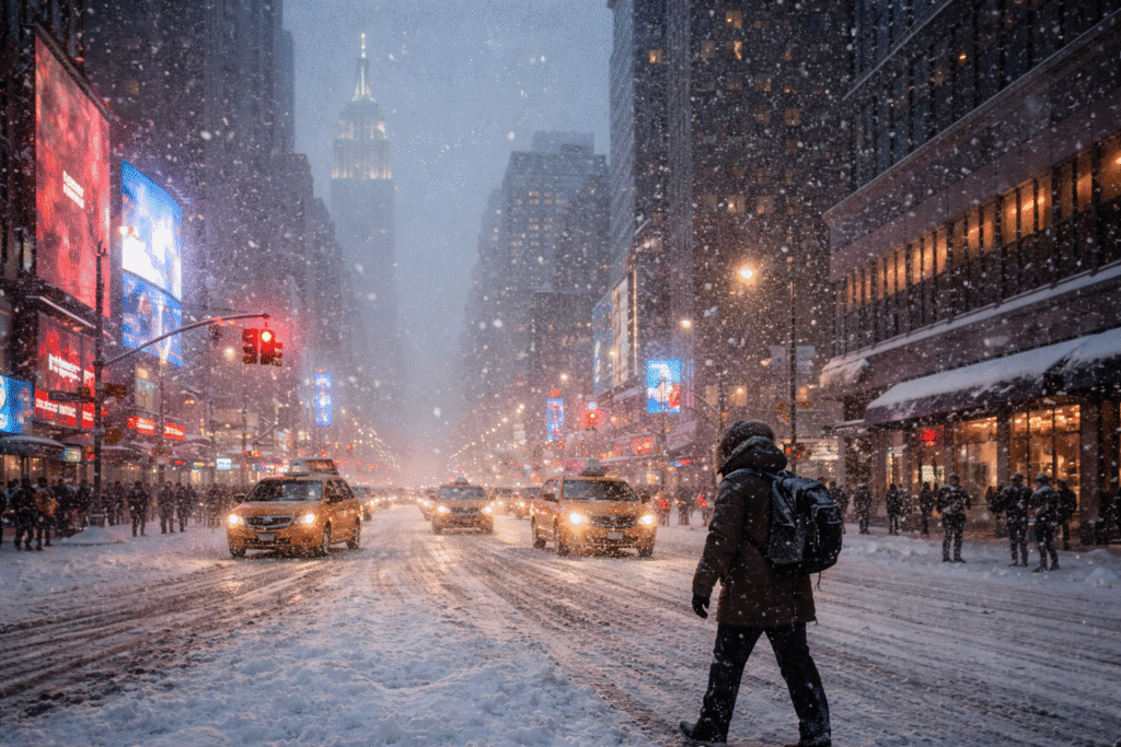
A powerful winter storm is set to impact New York City and the wider Tri-State area this weekend. Weather authorities have issued an urgent Winter Storm Warning as heavy snow, icy surfaces, and dangerous travel conditions move into the region. The storm is expected to peak from Friday night into early Saturday, creating widespread disruptions for residents, commuters, and travelers.
This system could become the most disruptive winter weather event of the season so far. Officials urge people to prepare early and limit movement during the height of the storm.
When the Storm Will Arrive
Snow is expected to begin spreading across the region late Friday afternoon. In New York City, snowfall may start between 5 p.m. and 6 p.m. Conditions will deteriorate quickly after sunset as colder air strengthens the storm.
The most intense snowfall is forecast between 8 p.m. Friday and 1 a.m. Saturday. During this period, snowfall rates could reach one to two inches per hour. Visibility may drop sharply, making travel extremely hazardous.
By early Saturday morning, heavier snow should ease. Lighter snow may linger through midday before tapering off.
Why This Storm Is So Intense
This winter system developed from a series of strong storms that crossed the western United States earlier in the week. As the system moved east, it encountered cold Arctic air over the Midwest. That collision intensified the storm before it reached the East Coast.
Cold ground temperatures will allow snow to accumulate quickly. Freezing conditions will limit melting, increasing the risk of ice on untreated roads and sidewalks.
Areas Most Affected by the Storm
The Winter Storm Warning covers a wide portion of the Northeast. The hardest-hit areas include:
- New York City
- Northern New Jersey
- Southern Connecticut
- Hudson Valley
- Catskills
- Poconos
- Western Long Island
Eastern Long Island and eastern Connecticut may see lighter snow totals. Some southern locations could also experience a brief mix of sleet or rain, which may reduce snow accumulation but increase icy conditions.
Expected Snowfall Totals
Snowfall amounts will vary across the region depending on location and elevation.
- New York City: 4 to 8 inches
- Northern New Jersey, Hudson Valley: 6 to 10 inches
- Catskills and Poconos: 8 to 12 inches
- Eastern Long Island and coastal areas: 2 to 4 inches
Heaviest accumulations will fall overnight Friday. Snowfall rates during peak hours may overwhelm plowing efforts, especially on secondary roads.
Travel Conditions Will Be Dangerous
Travel conditions will worsen rapidly Friday night. Heavy snow, strong winds, and poor visibility will make driving unsafe. Roads may become snow-covered within minutes during peak snowfall.
Airports across the region could face delays and cancellations. Rail and bus services may also experience disruptions. Travelers should check schedules in advance and expect delays through Saturday morning.
Walking will also be risky. Ice beneath fresh snow can create slick sidewalks and entryways.
Safety Tips for Residents and Travelers
Officials recommend taking the storm seriously and preparing ahead of time. Simple steps can reduce risk during severe winter weather.
- Avoid unnecessary travel: Stay off the roads during peak snowfall hours.
- Prepare your home: Ensure heating systems work properly. Keep extra blankets ready.
- Stock essentials: Food, water, medications, batteries, and flashlights should be on hand.
- Drive with caution: If travel is unavoidable, reduce speed and increase following distance.
- Dress for the cold: Wear insulated clothing and proper footwear to prevent slips and exposure.
Staying informed through local alerts and weather updates is also critical as conditions may change quickly.
What to Expect After the Snow Ends
Snowfall should taper off by Saturday afternoon. However, cold temperatures will linger throughout the weekend. Limited melting means icy patches may remain on roads and sidewalks well into Saturday night.
Temperatures may briefly rise on Sunday, leading to some melting during the day. That relief will be short-lived. Another blast of Arctic air is expected to arrive late Sunday into next week, bringing colder conditions back to the region.
Residents should remain cautious even after snowfall ends, as refreezing overnight can worsen road conditions.
Final Outlook for the Weekend
This winter storm poses a serious threat to travel and daily activities across New York City and the Tri-State area. Heavy snow, icy hazards, and freezing temperatures will create dangerous conditions from Friday evening through Saturday morning.
Preparation and caution will be key. Limiting travel, staying informed, and planning ahead can help reduce risks during this severe weather event. As winter continues, this storm serves as a reminder to stay ready for rapidly changing conditions across the region.
For more travel news like this, keep reading Global Travel Wire