Garmin has unveiled a major new update to its widely used Garmin Pilot application, delivering a suite of safety-enhancing features designed to give pilots more situational awareness than ever before. Available now for iOS users, the update introduces a graphical NOTAM overlay system and enhanced storm intensity mapping—two powerful tools that dramatically expand a pilot’s ability to interpret critical data quickly and accurately.
The update arrives at a time when aviation professionals are increasingly relying on high-precision digital tools to streamline planning and reduce cockpit workload. By integrating visual indicators directly onto airport diagrams and weather charts, the Garmin Pilot app continues strengthening its reputation as a comprehensive, go-to resource for pilots across general, commercial, and recreational aviation.
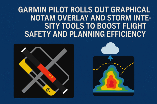
A Smarter, Visual Approach to NOTAM Information
At the heart of the new update is the graphical NOTAM overlay feature—an important leap forward from traditional text-based notice interpretation. NOTAMs (Notices to Airmen) provide essential alerts about runway closures, taxiway restrictions, and surface conditions, but until now, pilots often had to manually cross-reference text with charts or diagrams.
Garmin’s new system changes this by projecting active NOTAM details directly onto SmartCharts airport diagrams. When enabled, the overlay highlights closures, restrictions, and operational changes visually, eliminating ambiguity and helping pilots make immediate, informed decisions.
Clear Color Coding for Safety-Critical Information
To ensure accuracy at a glance, the new feature uses a defined color-coded scheme:
- Red shading marks runways, taxiways, or ramps that are completely closed.
- Closed runways also display a bold yellow “X” at each end of the runway—a universally recognized aviation marker.
- Conditional closures, meaning surfaces that are only closed under specific circumstances, appear in yellow, signaling pilots to review accompanying NOTAM text for full operational limitations.
- Time-based closures display a clock icon on the runway label, indicating restrictions that apply only at specific hours.
This visual system allows pilots to interpret NOTAMs instantly, reducing the chance of misinterpretation and increasing flight deck efficiency during both pre-flight and taxi operations.
Seamless Toggle Control
Pilots can turn the graphical overlay on or off based on their workflow preferences, ensuring that the interface remains adaptable for different flying operations or information needs.
FICON Code Integration Offers Real-Time Runway Condition Insight
Another notable upgrade is the inclusion of Field Condition (FICON) codes directly on runway labels. FICON codes quantify runway contamination and friction conditions, playing a vital role in landing and takeoff calculations.
By integrating FICON data on the chart itself, Garmin Pilot allows aviators to assess runway status instantly without switching screens or combing through text reports. The color of each FICON label corresponds to the runway’s lowest condition rating, giving pilots a rapid, visually intuitive understanding of braking performance and surface safety.
This streamlined approach not only saves time but also enhances precision—an advantage especially critical during winter operations, low-visibility conditions, or fast-changing weather.
Storm Tops Feature Adds Depth to Weather Awareness
In addition to the graphical NOTAM improvements, Garmin has introduced the Storm Tops feature, expanding the weather intelligence available to pilots. This tool shows the vertical development and intensity of storm cells, allowing aviators to assess whether a storm can be flown over, skirted around, or should be completely avoided.
Understanding storm height is essential for high-altitude flights and for determining the safest strategic routing. By integrating this into the mobile app—following its earlier debut on the Garmin Pilot Web platform—pilots now have access to comprehensive meteorological insights across all planning environments.
With evolving weather patterns becoming more unpredictable globally, the ability to visualize storm severity in real time supports safer, more responsive flight decisions.
A Significant Upgrade for Aviation Professionals
The latest enhancements represent Garmin’s ongoing commitment to modernizing cockpit technology and bridging the gap between raw data and actionable intelligence. By merging operational notices, surface conditions, and weather dynamics into a single platform, Garmin Pilot continues to reduce pilot workload and improve situational clarity.
For instructors, student pilots, and seasoned aviators alike, having integrated access to graphical NOTAMs and storm height data ensures a more holistic view of flight risks and operational factors.
Subscription Access and Availability
These new features—including the graphical NOTAM overlay and Storm Tops—are available to users with a premium Garmin Pilot subscription. SmartCharts, which support the NOTAM overlay system, are accessible for premium subscribers in the United States and the Bahamas.
While the features are geared primarily toward professional and advanced pilots, aviation enthusiasts and frequent users of Garmin’s platform will also benefit from the added visual intelligence and improved situational awareness.
Driving the Future of Digital Aviation Tools
With the aviation industry rapidly adopting digital platforms for safer and smarter operations, Garmin’s latest enhancements reaffirm its position as a leading innovator in flight technology. The new update marks a meaningful step forward, giving pilots intuitive, dependable tools that strengthen decision-making from pre-flight to touchdown.
By bringing essential operational data to the forefront in a visually rich format, Garmin Pilot is setting a new standard for modern cockpit support—and reinforcing the importance of clarity, precision, and advanced planning in every flight.
For more travel news like this, keep reading Global Travel Wire