
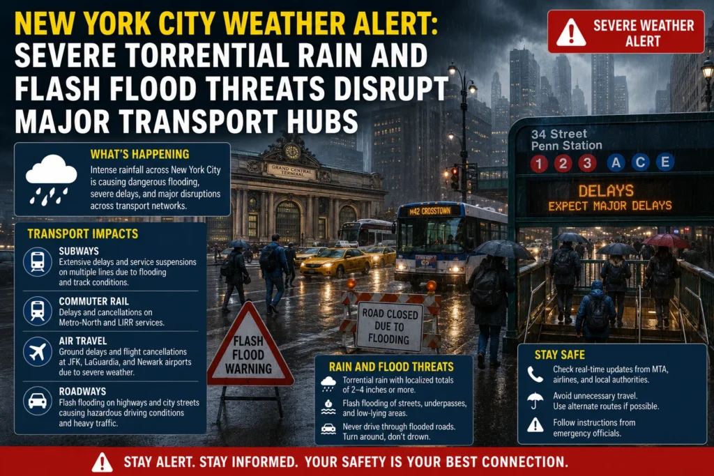
Travelers and daily commuters across the New York metropolitan area face severe transit disruptions following an urgent weather emergency. State and civic authorities have mobilized rapid response teams as a wave of intense thunderstorms hits the region, creating localized hazards and overwhelming infrastructure. For international tourists navigating the city and residents attempting their daily routines, municipal agencies have emphasized that conditions can deteriorate with minimal warning.
The core of the issue stems from an unseasonably intense weather pattern that has stalled directly over the northeastern United States. Having already endured consecutive days of scattered precipitation, the regional ground soil is entirely saturated, dramatically amplifying the risk of immediate surface runoff. Consequently, standard municipal drainage networks are operating at peak capacity, turning any additional heavy rainfall into an immediate threat to the city’s complex subterranean and surface transit grids.
Flood Watch Finalized Across the Five Boroughs
The National Weather Service has issued an expansive Flood Watch extending across New York City and its immediate coastlines. Meteorologists specializing in regional storm tracking indicate that the active system possesses the atmospheric dynamics necessary to yield exceptional rainfall rates, with certain bands capable of dropping two to three inches of water per hour. Total cumulative rainfall across the metropolitan expanse is projected to fluctuate between three and six inches, with isolated areas experiencing even higher concentrations if the storm systems repeatedly stall over the same neighborhoods.
The spatial footprint of this weather system extends far beyond the borders of Manhattan. Over 60 million people scattered across the wider Northeast and New England corridors find themselves under active flood watches or warnings. Coastal Connecticut, Rhode Island, parts of New Jersey, and the entirety of Long Island are facing identical environmental pressures, heavily restricting inter-state bus corridors and commuter rail lines.
Municipal Mobilization and Executive Safety Warnings
In response to the escalating forecast, New York City Mayor Zohran Mamdani announced the formal activation of the city’s Flash Flood Emergency Plan. This administrative order forces close inter-agency cooperation to secure critical infrastructure and protect vulnerable populations.
Municipal personnel have been deployed to clear catch basins, inspect historically flood-prone neighborhoods, and pre-position heavy rescue assets across the five boroughs. The New York City Police Department has proactively staged emergency tow trucks in every borough to rapidly clear stalled vehicles and prevent gridlock on major expressways.
The executive office issued a stern warning targeting individuals residing in basement apartments or ground-floor housing units, where rising waters pose an immediate, life-threatening danger. Emergency services are actively conducting direct outreach to these households, instructing occupants to establish immediate evacuation strategies to higher ground or nearby public facilities. The city has established designated emergency shelters across all boroughs, accessible to anyone requiring overnight protection from the storm.
Widespread Flight Delays and Rail Disrupted
The harsh weather conditions have caused significant ripple effects across the regional aviation network. New York City Emergency Management Commissioner Christina Farrell noted that flash flooding risks remain exceptionally high during peak travel windows, heavily impacting airport access roads and terminal operations.
Major Airport Impacts
The three primary commercial gateways servicing the metropolitan area—John F. Kennedy International Airport, LaGuardia Airport, and Newark Liberty International Airport—are experiencing profound scheduling adjustments. Reduced runway visibility, combined with severe lightning risks for ground handling crews, has forced federal aviation managers to implement temporary ground stops and significant spacing intervals for arriving aircraft. Travelers should expect:
Extensive departure and arrival delays exceeding two hours on domestic and transatlantic routes.
Strategic flight cancellations enacted by primary carriers to prevent regional terminal overcrowding.
Flooding on primary airport access roads, including portions of the Grand Central Parkway and the Van Wyck Expressway, which complicates taxi and shuttle access.
Subway and Rail System Friction
Beneath the streets, the New York City subway system is facing localized water intrusion, a recurring issue during high-volume downpours. Maintenance personnel are utilizing specialized pumping equipment to keep platforms and tracks operational.
However, line delays and automated route diversions have been implemented on several major lines to protect signaling equipment from moisture damage. Regional commuter networks, including the Long Island Rail Road and Metro-North lines, have similarly advised passengers to expect delayed arrivals and sudden schedule adjustments due to downed tree limbs and minor track washouts.
Official Guidance for Visitors and Commuters
To guarantee personal safety during this period of severe weather, emergency management officials have outlined a series of mandatory safety practices for anyone currently inside the alert zone.
First, individuals are urged to strictly avoid all non-essential travel while the core storm bands move through the city. Postponing tourist excursions, museum visits, and shopping trips until the flood watch expires reduces the strain on public safety personnel and keeps roadways clear for emergency vehicles.
Second, if transit is completely unavoidable, travelers must utilize public train networks rather than personal vehicles or rideshare services. Under no circumstances should a driver or pedestrian attempt to navigate through accumulated water on a roadway. Even shallow depths of moving water possess sufficient force to disable electronic vehicle systems or sweep an individual off their feet.
Finally, visitors should remain connected to real-time public safety notifications. The city’s official emergency communications platform provides automated text alerts regarding subway disruptions, road closures, and localized evacuation orders. Staying informed through verified government updates remains the most effective tool for navigating New York safely during severe seasonal weather anomalies.
For more travel news like this, keep reading Global Travel Wire